Dagestan is a little known territory in Southern Russia often overlooked for its unfamous neighboor Chechnya, mostly only seen as a land of mountains, lawlessness and home to many UFC fighers.
You planning a trip to Dagestan but aren’t sure where you must go and what you should not miss out ?
I absolutely adore the republic, in fact it might well be my favourite corner of Russia. I have been a few times back and forth during my extensive stay in the North Caucasus and here is a list of the 15 must-visit places in Dagestan !

Note : I highly recommend you to use Yandex Maps instead of Google Maps in Dagestan (and Russia in general). To pin the following places on your Yandex Maps app just click on the 📍 at the left bottom of the map.
1 – Derbent old town
Дербент – Derbent is the must-visit city in Dagestan and the North Caucasus in general. It is believed by locals to be 5000 years old but historians claims it’s “only” 2500 years old. Either way, Derbent is one of Russia’s oldest cities. Located right between the mountains and the Caspian Sea, the old town, the citadel and the Naryn Kala fortress are UNESCO heritage sites.
With its fortifications, cobblestone streets, mosques, armenian church, synagogue and huge melting pot of people, Derbent is no boubt unlike any other city in the country. If you have to visit one city in the North Caucasus, this is it !


Trains from various cities in Russia including Moscow, buses from Grozny, shared taxis and marshrutkas from Azerbaijan.
Tip : if you travel off season it is most likely that hostels will be closed, they open in the summer.
2 – Sary Kum desert
Бархан Сарыкум – Dagestan’s Sary Kum desert is a sand dune located about 20 kilometers from Makhachkala. With its 3 hectares of sand dunes, this is one of the largest in Eurasia with hundreds of plants species including endemic ones.
The name Sary Kum comes from the Kumyk language and means “yellow sand”.
Legend has it that Sary Kum was created as the resultt of a love triangle between a girl and two brothers. A young girl lived on an island in the middle of a lake and declared she would marry the one who would turn the water into sand. One of them succeded, creating the Sary Kum desert.


From Makhachkala’s market square, take the bus N°19, 7, 77 or trolleybus 3 to the northern bus station then any bus heading to Chechnya/Ingushetia and stop at Korkmaskla village, walk about 20 minutes to the Reserve. See Yadex maps for detailed itinerary.
There’s a 50₽ entrance fee that give you access to a wooden path to explore Sary Kum.
3 – Sulaksky Canyon
Сулакский каньон – Sulaksky canyon is one of the top natural pride of the republic, every local in Dagestan will tell you to go and see it. It is also one of Europe’s deepest canyon and even deeper than the Grand Canyon in the USA, it’s about 50 kilometers long.
The canyon might well be the most visited natural sight in Dagestan and offers absolutely gorgeous panoramic views ! There’s no safety barrier nor any properly organised viewpoints, watch out for the wind.


The easiest way to reach the canyon is from Dubki village. To get there take a bus from Makhachkala or Buynask to Dubki. Check Yandex Maps for detailed itinerary as well as walking paths to the “viewpoints”
During the summer season, boat tours can be organised.
4 – Tobot waterfall
Тобот – Located on the Khunzakh plateau, the small Tobot river drops right in the Tsolotlinsky canyon creating an impressive waterfall. Spring and early summer are the best time to visit when the river flow is heavier due to the snow melting in the mountains.
According to different sources, the waterfall is between 70 to 100 meters high. The viewpoint is located in Khunzakh village.
Next to Tobot is the Arani village famous for its fortress also called the Khunzakh fortress built in the 19th century during the Caucasus war.


To get there, take the daily marshrutka N°642 from Makhachkala’s northern bus station. The ride last about 3 hours.
5 – Gunib
Гуниб – Standing high on a plateau at 1500 meters above sea level, Gunib has an exceptional location. A natural fortress, fortified with walls and towers that can still be seen today for some. The main way to the village is a serpentine road via Shamyl’s gate.
This very aul was the last battle of the 19th century Caucasus war where Imam Shamyl was captured .The fortress was built by the russian afterwards.
Gunib is a great base to explore the area including Chokh, Gamsutl and the 2350 meters high mount Mayak nearby. The central square is small and everything is within walking distance : market, cafés, restaurants, shops and museums.


Daily marshrutkas from Makhachkala’s northern bus station. They leave when full.
6 – Chokh
Чох – Chokh is a pictureque aul located near Gunib and Gamsutl. Narrow paved streets and traditional stones houses with a stunning panoramic views of the mountains make this picturesque Avar village a must-visit in Dagestan.
Located in the Andalal valley, “chokh” in the Avar language means “stop”. It was a junction on the Silk Road back in the days, however locals were living out of agriculture and made terrace fields to cultivate. Today the terraces can still be seen but only animals grass in them. Now the fields are mostly located in the lowlands


Chokh is located less than 20 kilometers from Gunib. As far as I know there’s no public transport to the village so one must take a taxi or hitchhike (quite easy) the way.
7 – Gamsult
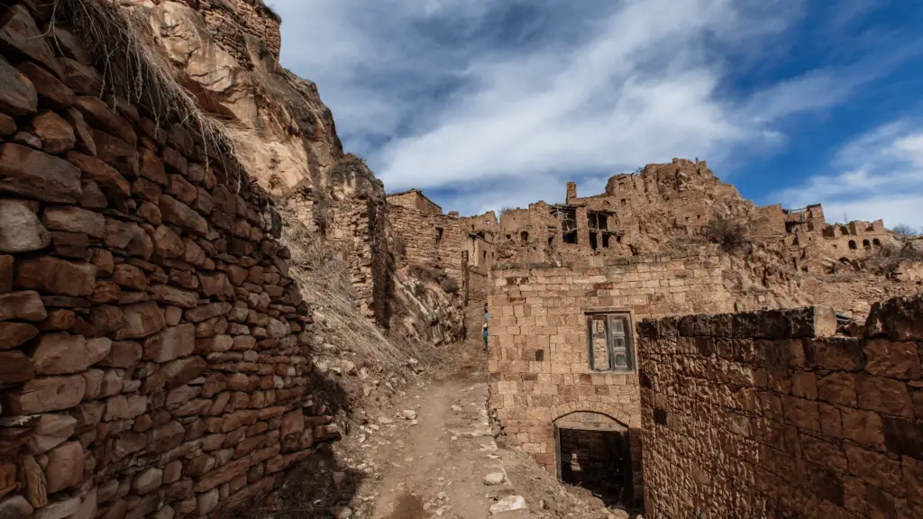
Гамсутль – Gamsutl is a picturesque fortified Avar village built on top of a mountain and is the most famous abandonned aul in Dagestan. It is surrounded by high cliffs and perilous slopes, making it difficult to access for enemies back in the days and is believed to be one of the oldest settlement in the republic.
They are different stories as why it has been abandonned : plagues, forced collectivization by the Soviets, or people simply left for a better and easier life in towns. The aul’s last remaining resident passed away in 2015.


Gamsutl is easily accessible from Chokh. Take a marshrutka to Gunib, then a taxi or hitchhike to Chokh and walk up to Gamsutl.
You can hike up from the foothill in just an hour and a half through the ancient path. The way is marked on Maps.me
8 – Saltinsky underground waterfall
Салтинский водопад – Located next to Salta village in the Kudalinsky canyon, Saltinsky is the only underground waterfall in Dagestan, yet it is not truly under the ground even though it looks like it.
The waterfall is 20 meters high but the light coming from above makes it really impressive. In winter time the water is frozen, however the best time to visit in my opinion is spring until early summer when snow melts in the mountains and makes the small Saltinka river a bit bigger.
Wear proper shoes as it’s slippery and go on a sunny day.

There’s no direct public transportation to Salta, you must take a bus to Gunib and then find either a taxi driver or hitchhike to the village.
There’s an unofficial waterfall entrance fee of 50₽ during the high touristy season.
9 – Kubachi
Кубачи – Kubachi is one of Dagestan most famous aul. Back in the days every village was specialised in a field or a craft, Kubachi people made metal especially silver weapons such as the famous kindjal, a Caucasian dagger.
Kubachi is a rather large Dargin village located at 1800 meters high in the mountains but has no street names nor signs for jewllers or local craft shops. Ask locals for direction.
The Kubachi language spoken there is a dialect from Dargin language.
Among the namesless narrow streets of the aul is the Akayla Kalya watch tower. The 16 meters high restaured tower has been turned into a museum and a viewpoint.


Marshrutkas to Kubachi leave early morning from both Makhachkala and Derbent.
10 – Old Kakhib
Кахиб – The old Kakhib village is an abandonned aul like Gamsutl built on the mountain side just above the Kakhibtlyar river. The last inhabitant left in the 1980’s.
Here you can see a couple of stone towers that have been restaured and standing at 20 meters high. These stone towers are similar to Ingush ones found all across Ingushetia’s mountains but much more accessible.


There’s no direct public transport to Kakhib. You must take a bus to Hebda on the main road and then find a taxi or hitchhike to Kakhib.
Old Kakhib is located only a few kilometers away from the following village of Goor and the distance between the two can easily be hiked.
11 – Goor
Гоор – Goor is another abandonned yet stunning aul located next to Kakhib. It has 3 stones towers still standing. Back in the days there were 7 defensive towers and other residential ones. Some said they have been up to 25 meters high. The ones still standing are between 10 to 15 meters.
Goor’s location is spectacular and giving Norway vibes with its “Troll tongue” rock formation standing out of the cliff’s edge.


Same as for Kakhib, there’s no public transportation, you must take a marshrutka to Hebda then find a driver to take you to Goor.
Easily accessible from Kakhib village, you can hike the few kilometers between the two villages.
12 – Kezenoy-Am lake
Озеро Казеной-Ам – Located at 1869 meters in the mountains between Dagestan and Chechnya, Kezenoy – Am is the largest lake in the North Caucasus. Its name means “Blue lake” and truely is a blue gem not to miss when in Dagestan or in the North Caucasus in general.
It is best to visit during the warm months as it is frozen and covered of snow in the winter. There is a hotel and restaurant on the Chechen side.


The distance between Grozny and the lake is 100 kilometers and the one between Makhachkala and the lake is twice that. It is easier to reach Kezenoy Am from Chechnya.
There’s no public transportation to the lake on either side. You can go to Vedeno by public transport but for the last 20 kilometers up the serpentine route you must take a taxi or hitchhike.
I hitchhiked there from Grozny once and it worked just fine. Locals are always very helpful and friendly.
13 – Akhty & the Samur valley
Ахты – Very much off the beaten track even for local tourists, Akhty and the Samur river valley is the very south of Dagestan ad overlooks northern Azerbaijan from across the border. The area is populated mostly by Lezgin and Rutul people. Nearby Akhty village there are 14 hot water sources, some organised for swimming.
The old part of Akhty village is a must-visit. Roam around its narrow streets of traditional houses and walk to the stone arch bridge over the Akhtychai River. The village is also home to the most southern tarist era fortress in Russia, the Akhtynskaya built in 1839 and attaked by Shamyl’s troups a decade later with little results.
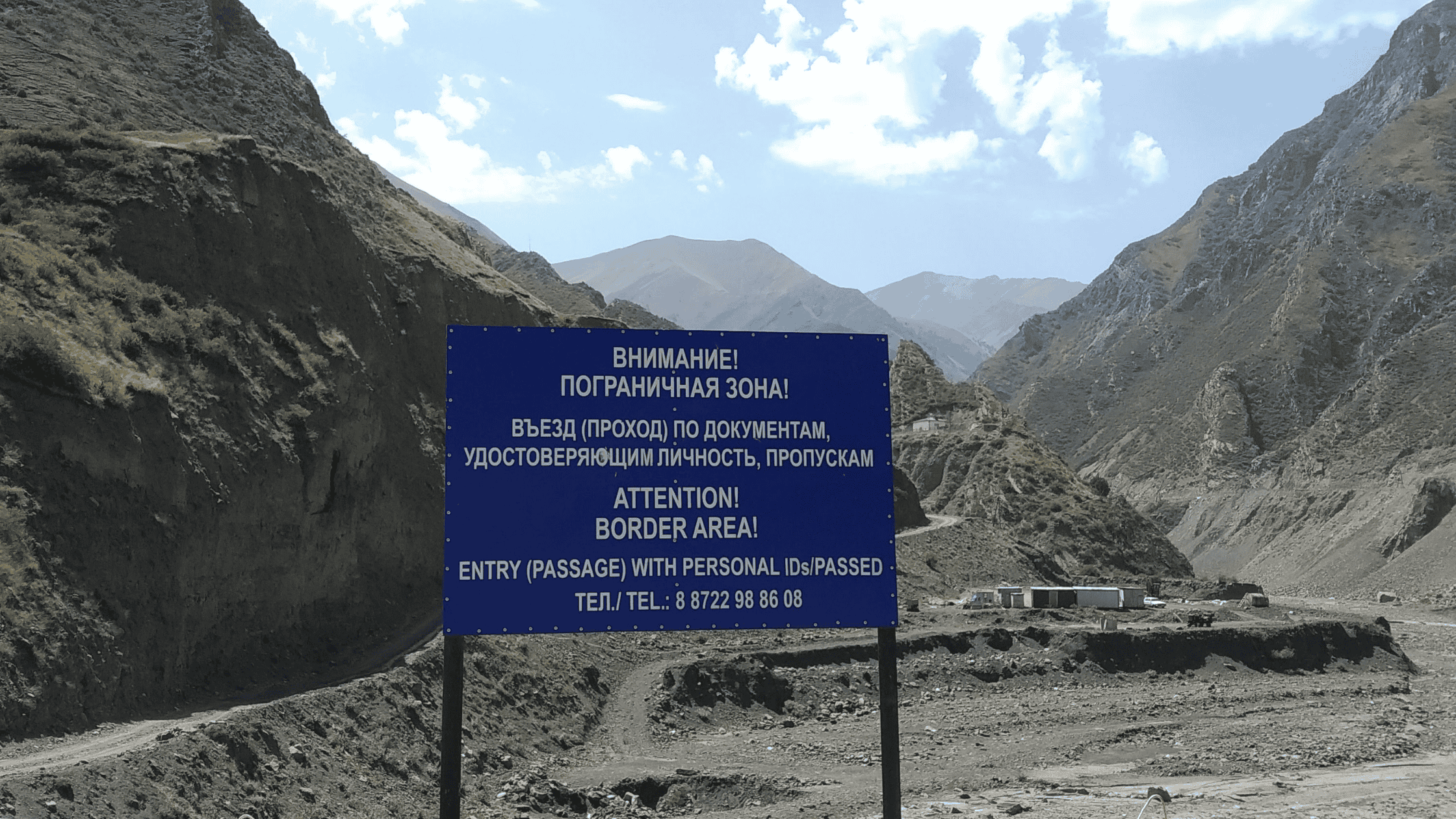
The Samur valley does’t require any border zone permit. You may see border crossing posts to Azerbaijan in the middle of nowwhere, however only locals from the villages nearby are allowed to cross as they have family on the Azerbaijani side. The area is best visited late spring when the mountains are green.


Shared taxis depart daily from Derbent southern bus station to Akhty. They leave when full and it is best to try to find a ride in the morning.
If you plan to travel to other small villages down the Samur valley, know that transportation is very irregular and most likely non existent during the week ends.
Hithchiking works well when there’s a vehicule …
14 – Kurush
Куруш – Located at 2 560 meters, this Lezgin aul is Russia’s southern most village and also the highest settlement in the Caucasus and in Europe ! Home to some 800 ethnic Lezgin people, Kurush is located next to Shalbuzdag, one of Dagestan’s highest peak and holy mountain.
Kurush has jawdropping surroundings, making it totally worth the bumpy drive from Derbent. Best to visit late spring when the mountains are very green.
Disclaimer : Kurush may be/is (who knows ? I’m not entirely sure) within the russian border zone. Technically foreigners need to have a border zone permit to travel there. However I saw no sign, no soldiers, no post control on the road. I had a border zone permit in case I met them.
You can try to go without a permit, there might be no one to check on the way in. However, if you get caught there, or on the way back without it, you face troubles. Big ones. It takes 30 days to get a border zone permit in Dagestan, the FSB office to pick it up is in Kaspyisk and the friendly officer there speaks more spanish than english.
Click here to read my detailed guide to get a permit.


As far as I know there’s no public transportation to Kurush, but you can get a taxi or find someone to drive you the way from Akhty.
15 – Shalbuzdag holy mountain
Шалбуздаг – Last but not least Shalbuzdag, the Mecca of Dagestan ! Mount Shalbuzdag is one the highest peak of the Eastern Caucasus mountain range at 4142 meters high and a holy mountain for muslim Caucasians.
The rugged red-ish mountain is easily visible from afar, and every year between the 20th of July and 20th of August is organised a pilgrimage to the mountain’s top. Locals say climbing to Shalbuzdag 7 times is like to make Hajj in Mecca.


How to hike the Pilgrim’s way of Shalbuzdag ? The hike starts at Miskinja, a village at the bottom of the mount. Most people take a UAZ mini van to Pir Suleiman, Sheikh Suleiman’s grave and start walking from there. On the way you will reach Zolotoy Erenler mosque, where during the pilgrimage people eat and spend the night for free.
Next you will get to Zam-Zam small lake, which is slightly frozen even in the middle of summer; people drink its holly water. The path to the top goes by Grekomer a narrow passage between rocks, locals believe a sinner will get stuck in between. Add another kilometer and you’ll reach the end of the hike, however it’s not the highest point that only experienced hiker should attempt.
It should take you a couple of days with a night in the mountain to reach Shalbuzdag’s top. Make sure to wear proper shoes and clothes, take enough food and water with you and tell someone where you are heading for safety purposes. There is of course no phone signal.
It’s mandatory to have an insurance to travel in Russia and apply for a russian visa (including the e-visa)
I recommend Attollo Assistance (24/7 assistance, medical expenses up to 35 000 €, repatriation)

Let me know in the comments bellow which place(s) in Dagestan you would like to visit most !
DON’T FORGET TO SHARE THIS POST !
Enjoy what you read and learn? Think about buying me a chai to support the blog !