Eastern Turkey is one of the least visited parts of the country, and one of the most fascinating. As part of my journey across the Caucasus, travelling from Nakhchivan to Grozny, I crossed the far east of Anatolia: vast plateaus, snow-capped mountains, Kurdish towns, Russian-era architecture and medieval Armenian ruins scattered along a border that has remained closed for more than three decades.
I had passed through this area years ago, but back then my timing was too tight to explore properly – from Maslenitsa in Moscow to Nowruz in Akre, Iraqi Kurdistan – so this was my chance to finally see it in depth.
Over several days, I travelled from the Nakhchivan border to Doğubeyazıt, Kars and Ani before continuing north towards Georgia. Along the way I encountered the fairytale-like Ishak Pasha Palace, the snow-capped silhouette of Mount Ararat (Ağrı Dağı), which dominates the horizon from almost every direction, and explored medieval Armenian monuments at Ani, just metres from the Armenian border.
If you’re planning a trip to eastern Turkey, or simply curious about this fascinating corner of what I like to call the Turkish Caucasus, this post covers the highlights of my route, practical logistics and the places that left the strongest impression on me.
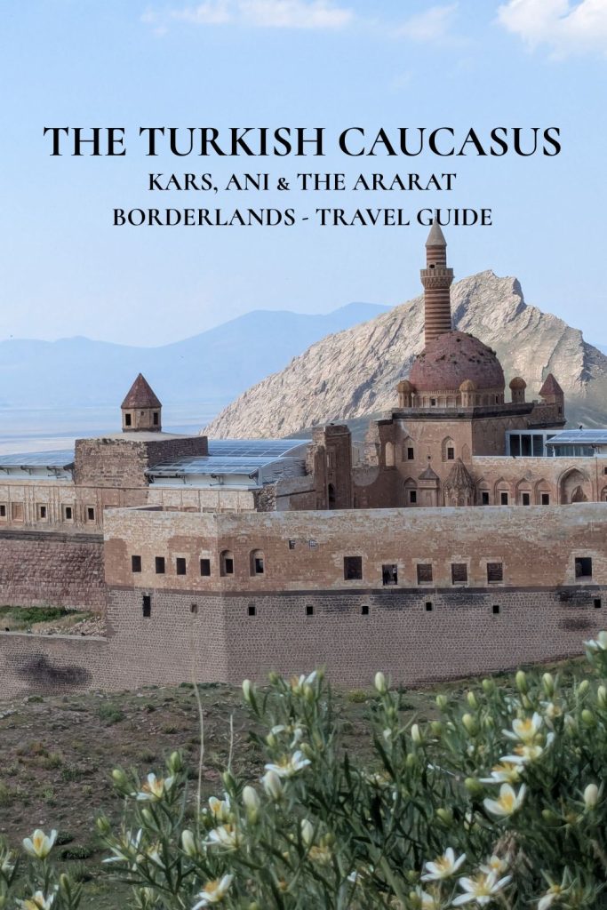
The Ararat borderlands: Doğubeyazıt, Ishak Pasha palace & mount Ararat
Last time I was in this part of eastern Turkey, I somehow (I actually know how) ended up drinking tea and eating baklava with the Turkish secret services. As hospitable as they were, I did not particularly want to repeat the experience this time, so I planned carefully.
On this trip, my first stop was Doğubeyazıt, a predominantly Kurdish town just a few dozen kilometres from the Iranian border. Sitting at the foot of Ağrı Dağı mostly known as Mount Ararat, Turkey’s highest mountain, it is also the most convenient base for visiting one of the region’s most spectacular sights: Ishak Pasha Palace.
Doğubeyazıt itself isn’t what I’d call a beautiful town. It’s busy, dusty and somewhat chaotic, with plenty of unfinished or unpaved streets. But I actually enjoyed spending a night there. The centre is lively, people were very friendly and helpful (didn’t expect anything less from Kurdish people anyway), and the town has a very local feel that you don’t get in the more touristy destinations further west.
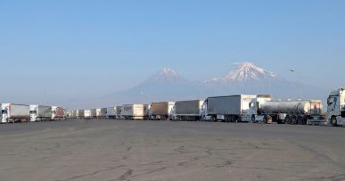
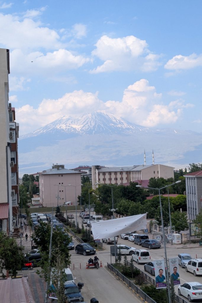
And then there is Ararat. The mountain dominates the landscape around Doğubeyazıt, although its summit is often hidden behind clouds. I was lucky enough to see it completely clear, and it really is an impressive sight.
Doğubeyazıt is a practical base for exploring the area, as minibuses make getting around super easy. I stayed at the Ararat Hotel, right in the centre of town, next to pedestrian İnegöl Caddesi, where there are plenty of small restaurants, döner places, tea shops and ATMs. Worth noting that the view on Ararat is incredible if you pop your head out of the balcony.
My Saturday night was considerably more lively than expected: a Kurdish wedding procession passed through the town, with decorated cars and dudes dancing inside and some more dancing in the square directly below my window. It wasn’t exactly a quiet night (but I had earplugs), but it was certainly momerable!
Visiting Ishak Pasha Palace
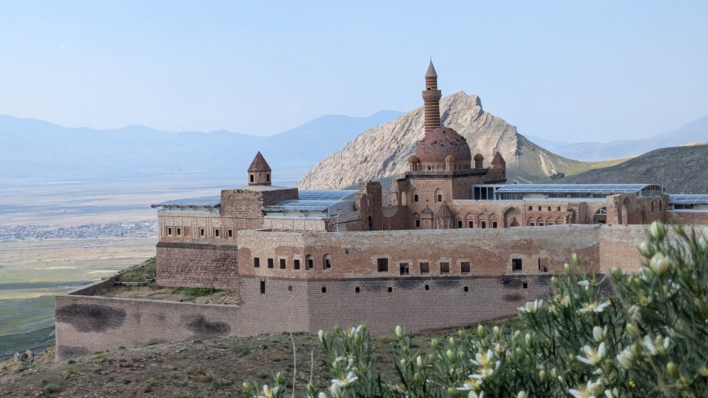
The main reason most travellers come to Doğubeyazıt is Ishak Pasha Palace, a spectacular 17-18th-century palace complex perched on a hillside above the town.
Getting there is very easy. Across the square from Ararat Hotel opposite the Eastwhite coffeeshop, look for the green minibuses heading to Ishak Pasha Palace. I paid 25 TL each way and the minibus took me all the way up to the site in less than 20 minutes.
I visited on a Saturday afternoon in early July, so there were plenty of local visitors around, including a couple having their wedding photos taken. Despite the crowd, I was pleasantly surprised by how well maintained the palace was.
The minibus goes all the way to the end of the road and stopping next to Ahmed-i Hani Türbesi, the open and free-to-visit tomb of the Kurdish scholar and poet Ahmed-i Hani. From there, you can continue downhill on foot towards Eski Bayezıd Cami, an old mosque that was unfortunately closed when I visited, before finishing at Ishak Pasha Palace.
The architecture is genuinely impressive, with elaborate stone carvings and details throughout the complex. Some of the rooms are now protected by glass roofs, which allow you to see the interiors while protecting them from the elements. There is also a mosque inside the palace that you can visit. Ladies, bring a scarf to cover your head.
One small disappointment: despite its spectacular position, Mount Ararat is not visible from Ishak Pasha Palace.
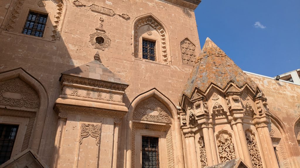
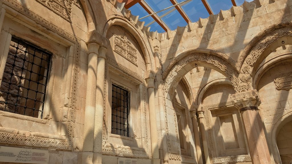
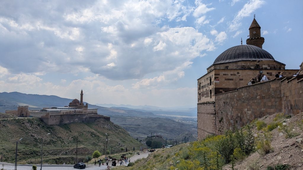
Getting around Doğubeyazıt and useful information
• Doğubeyazıt to Iğdır: 200 TL by dolmuş minibus. They leave when full.
• Doğubeyazıt to Ishak Pasha Palace: 25 TL each way by the green minibus.
• Accommodation: I stayed at Ararat Hotel, which I recommend, the young receptiovist Yildiz is very friendly and knowledgeable.
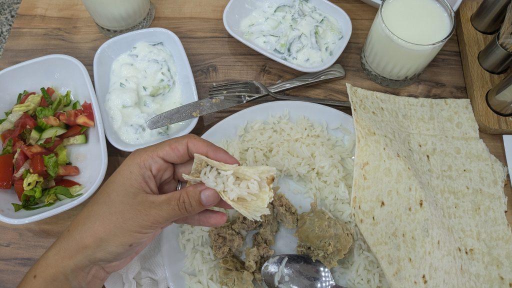
• Restaurant: Try Abdigör Köftes, the town’s signature dish, at Ergül’ün Mutfağı – excellent service!
• You’ll often see Doğubeyazıt abbreviated as D. Beyazıt on buses and at the bus station.
How to get from Doğubeyazıt to Kars via Iğdır
If you’re travelling around eastern Turkey by public transport like me, Doğubeyazıt to Kars is a straightforward route, although you’ll need to change in Iğdır.
1. Doğubeyazıt to Iğdır by dolmuş minibus
There are dolmuş (the Turkish equivalent to a marshrutka) from Doğubeyazıt to Iğdır, and t departure point is here. The journey cost 200 TL.
These dolmuş don’t seem to follow a strict timetable: they leave when full. I travelled on a Sunday morning and waited around 45 minutes for mine to fill up. We eventually left at around 10:20 am, so if you arrive early, you may get lucky and find one leaving sooner.
The journey itself was quite interesting. Along the way, I noticed traditional stone-built village houses and piles of kiziyak, dried blocks of manure used as fuel for heating during the winter. And, of course, there was Mount Ararat in the background – although its summit was hidden by clouds that morning. I was lucky enough to have a clear view the previous day.
There is also a Jandarma checkpoint near Iğdır University. On my journey from Doğubeyazıt to Iğdır, the dolmuş was stopped and the officer checked the IDs of every passenger. I noticed this happening on the journey to Iğdır but I didn’t experience the same check when travelling in the opposite direction.
2. Iğdır to Kars by bus
In Iğdır, you can continue to Kars by a small bus (not a dolmuş). I paid 400 TL for my ticket.
When I travelled, there were five departures a day, at approximately: 8:00 am; 10:00 am; 12:00 pm; 2:00 pm; 5:00 pm. Schedules can of course change, so confirm the times locally before relying on them, particularly if you’re travelling outside the main season.
The ticket office I used was operated by Serhat Iğdır, here on Google Maps. It’s right next to a tea house, so if you’re having trouble finding it, don’t hesitate to ask people drinking their çay. The two departure points for Doğubeyazıt and Kars are only about five minutes’ walk from each other but my previous driver drove me there.
The staff at the ticket office were very friendly, and the young man I spoke to spoke English. My bus left right on time, and seat numbers were written directly on the seats. The journey to Kars took around two hours. The road climbs through the highlands between Iğdır and Kars, and my small bus had hard time on some of the hills!
Solo female travellers: I found the journeys through eastern Turkey very easy as a woman travelling alone. On this small bus, women have seats at the front, and on the other dolmuş you can simply ask to sit in the front next to the driver, I was told yes every single time.
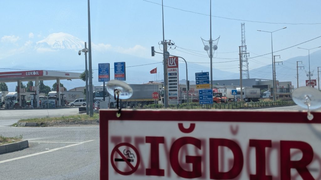 View of Ararat, top left of the picture
Kars travel guide: Russian echoes on the Anatolian plateau
After leaving Doğubeyazıt, I continued north towards Kars, crossing the highlands around Iğdır and Digor. The landscape gradually changes as you climb back onto the Anatolian plateau, and Kars feels noticeably different from the towns further south.
If Doğubeyazıt feels distinctly Kurdish, Kars has a much stronger Caucasian and Russian imprint. The city remained under Russian rule from 1878 to 1918 – only 40 years, but long enough to leave a very visible mark on its architecture, street layout and even some of the names you’ll encounter. The Russians rebuilt parts of the city according to a grid plan, with broad streets and distinctive stone buildings inspired by Baltic architecture.
Kars isn’t a city that immediately overwhelms you with major sights. I actually think its appeal lies more in wandering around, looking at the old stone buildings, climbing towards the castle and noticing the different layers of history around you.
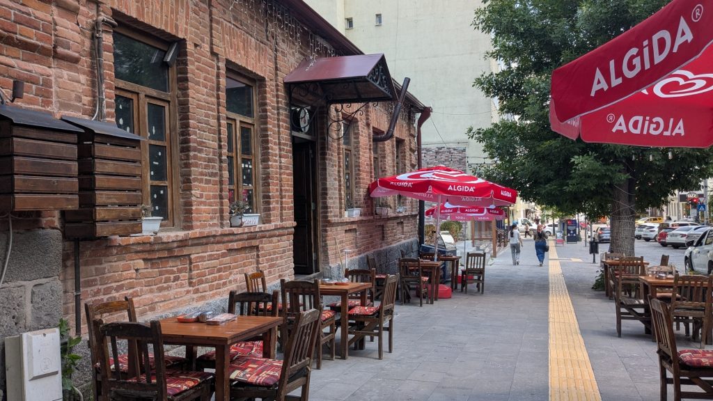
I first visited Kars in winter, when the dark basalt buildings and often gloomy skies gave the city a rather depressing atmosphere. Coming back in summer was a completely different experience. Under a blue sky, with cafés and restaurants spilling out onto terraces and people sitting outside, Kars felt much more lively and enjoyable.
What to see and do in Kars
• Kars Castle
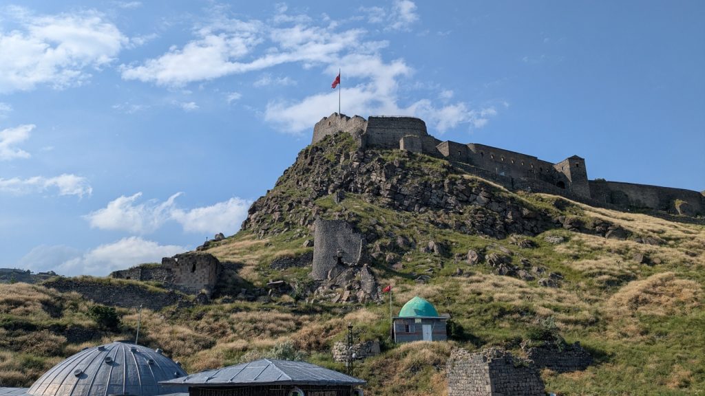
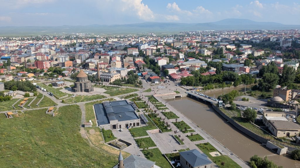
Sitting above the city, Kars Castle (Kars Kalesi) is the obvious place to start. The fortress has a long and complicated history, but for me, the views are probably the main reason to make the climb. From the top, you get a good sense of Kars’s position on the Anatolian plateau and can see the city’s mixture of historic buildings, mosques and more recent development.
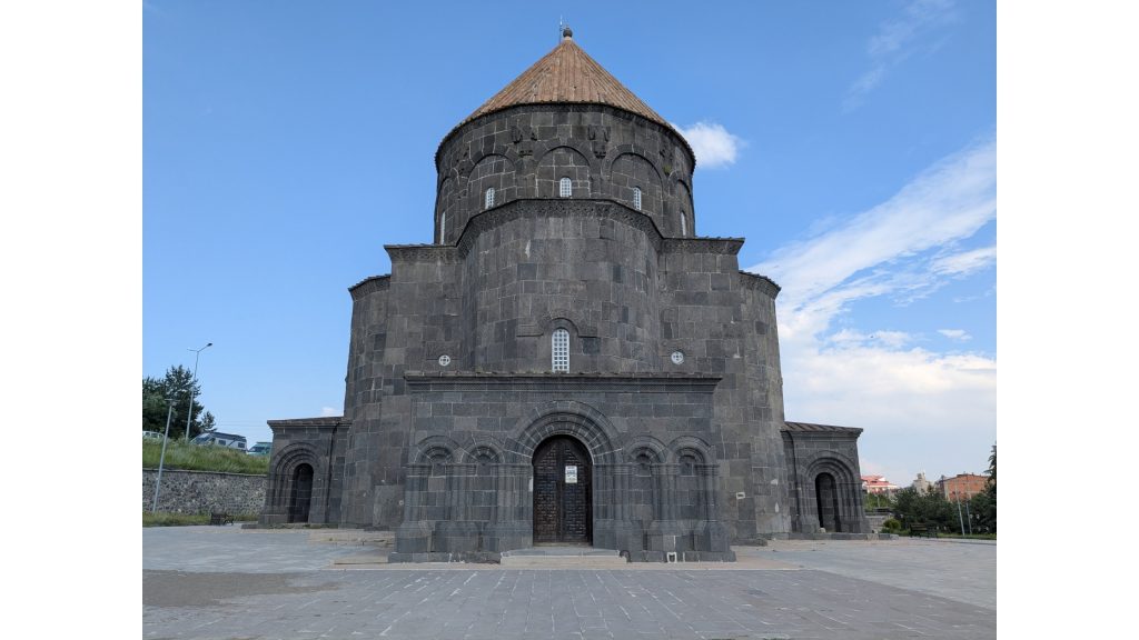
On the way up, don’t rush straight to the castle. You’ll pass several interesting buildings, including Evliya Mosque, the Church of the Twelve Apostles (On İki Havariler Kilisesi) and the Taş Köprü, the historic stone bridge crossing the Kars River.
The Church of the Twelve Apostles is particularly interesting because its history reflects the layers of Kars itself. Originally built as an Armenian church in the 10th century, it was converted into a mosque, later used as a Russian Orthodox church during the Russian period, and a mosque again today called Kümbet Mosque.
• Explore Kars’s Russian-era architecture
One of the things I enjoyed most about Kars was simply walking around and looking at its Russian-era buildings. Head along Atatürk Caddesi and through the surrounding streets and you’ll see plenty of the distinctive stone buildings constructed during the Russian period. The broad, straight streets feel surprisingly different from the chaotic urban landscapes you encounter elsewhere in eastern Turkey.
And then there are the Russian references scattered around the city. You’ll come across places named Pushkin and Raskolnikov, for example, a slightly surreal reminders that this corner of modern Turkey was once part of the Russian Empire.
The architecture is particularly interesting because it doesn’t look stereotypically “Turkish”. Many of the buildings are made from neatly cut local basalt and follow the grid-like urban plan established during the Russian period. The Kars Governorate currently lists around 190 protected buildings belonging to this architectural heritage.
• Don’t miss Fethiye Mosque
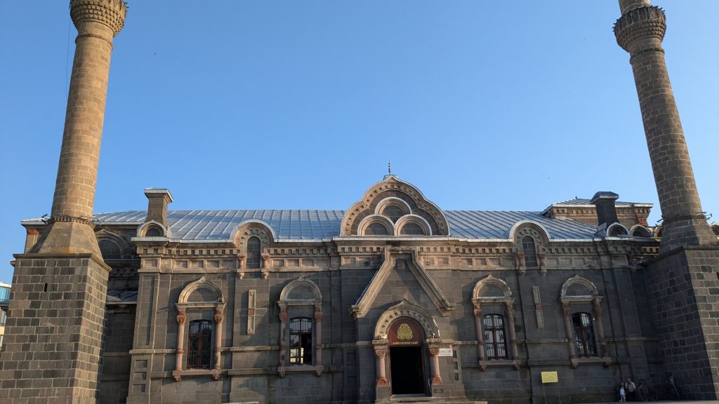
One building that really caught my attention was Fethiye Mosque (Fethiye Camii). It was originally built as Alexander Nevsky Church, an Orthodox church constructed for the Russian Cossack soldiers stationed in Kars after the Russian takeover. It was later converted into a mosque.
What makes it particularly strange-looking today is the combination of the original Russian Orthodox structure with the later Islamic additions. The original onion domes were removed and minarets were added, creating a building that looks like neither a typical Russian Orthodox church nor a conventional Turkish mosque.
Honestly, it’s probably the strangest buildings I’ve seen in the city, and absolutely worth seeking out if you’re interested in Kars’s Russian history.
Where to stay in Kars
On the recommendation of a friend, I stayed at Kent Ani Hotel, which I chose mainly for its good price and central location and I’d happily stay here again.
Despite the fact someone had clearly smoked in the room before my arrival, the bed was comfortable and all the staff were exceptionally friendly. The hotel is around 10 minutes on foot from Kars Castle and the main streets lined with restaurants and cafés. It’s also less than 10 minutes from the bus stop for Ani, which makes it particularly convenient.
What to eat in Kars
Don’t leave Kars without trying some of the local cuisine. The food here reflects the city’s position at the crossroads of Anatolian and Caucasian, and some dishes feel remarkably familiar if you’ve travelled elsewhere in the Caucasus.
Two places I particularly recommend:
1. Hanımeli Kars Mutfağı
This restaurant specialises in regional cuisine, and I went specifically to try Gafil Gonah, a traditional Kars dessert that is said to have Azerbaijani origins, but which I’d never encountered elsewhere (not even in Azerbaijan).
It’s served hot and prepared with honey and several different spices. The restaurant told me that it takes some time to prepare, so don’t order it expecting an instant dessert. Mine was apparently intended for four people. I have a sweet tooth so I ate about half of it myself and took the rest back to my hotel.
It’s delicious: sweet, rich, warm and heavily spiced, and definitely one of the more unusual desserts I’ve encountered on my travels. If you see Gafil Gonah on the menu, make sure to give it a try.
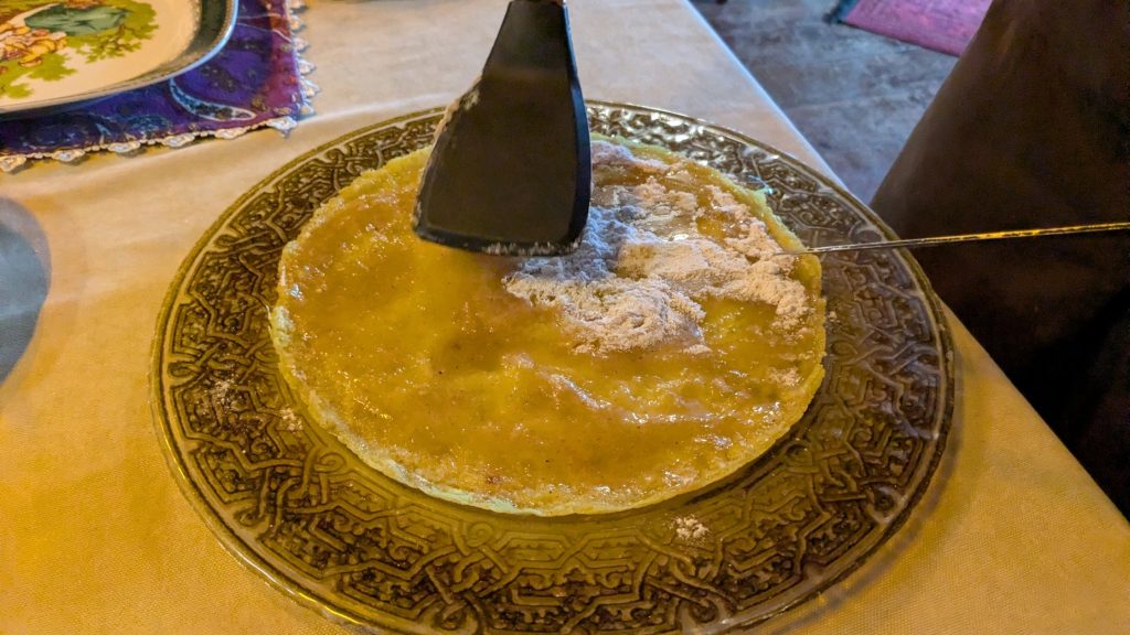 Gafil Gonah
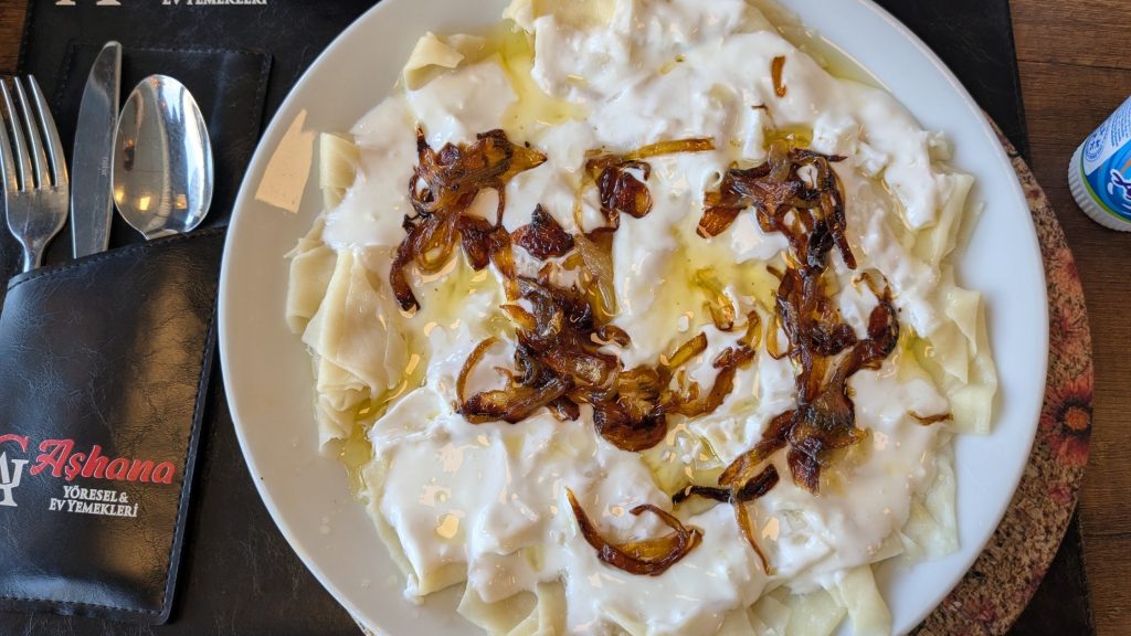 Hıngel (Hangel)
2. Aşhana
For something more savoury, head to Aşhana, a restaurant away from the touristy centre. This is where I tried hıngel (or hangel), a dish officially recognised as part of Kars’s traditional cuisine.
It’s made with small pieces of dough served with garlic yoghurt and butter-fried onions. It reminded me somewhat of Dagestani khinkal, minus the meat or Levantine macarona bil laban, kind of a mix of both. The Kars version is wonderfully simple and very, very garlicky, so if you’re planning to make out with someone afterwards, perhaps order something else. The portion was huge but after roaming around the ruins of Ani, it was perfectly filling and genuinely delicious.
I share the behind the scenes of my travels (real-time stories, messy bits etc) on Telegram

Ani ruins: visiting Armenia’s medieval capital city of 1001 churches
Ani is often described like it’s a recent loss; the vast majority of the blogs and vlogs I consulted before my visit presented it that way. This is wrong if we imply that Ani remained under the sovereignty of an Armenian state until its abandonment.
Ani ceased to be under the rule of an Armenian state in the mid-11th century (quick reminder, we’re in the 21st century). Later, in the 13th century, while the city was under Georgian rule, it was administered by Armenian princes, notably the Zakarian (Mkhargrdzeli) dynasty. But this was not an independent Armenian state.
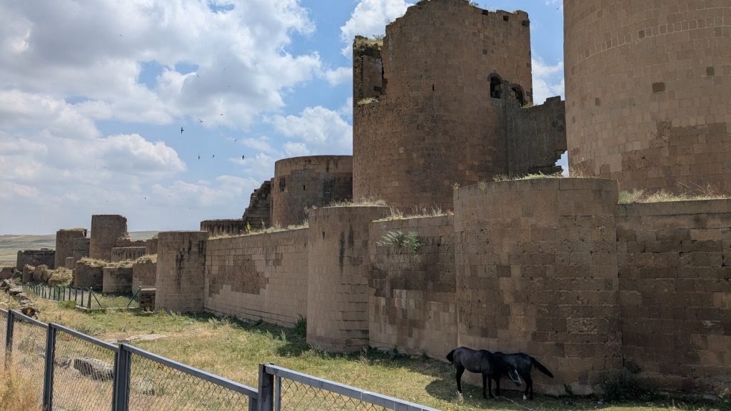
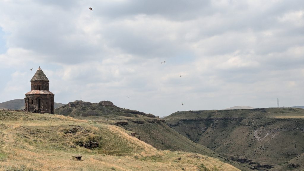
That historical nuance matters, particularly because Ani’s history is still interpreted very differently depending on who is telling the story. What is beyond dispute is that Ani was once one of the most important cities of the medieval Caucasus, and walking through its ruins today is quite extraordinary.
The site is huge, but at a normal pace you can see the main sights in around two hours. If you have your own vehicle and more time, however, I’d strongly recommend slowing down and exploring further.
One of the things that surprised me was that Ani Castle (Ani Kalesi) is no longer off-limits. I was able to walk all the way up to it, with views across the ruins, the gorge and the Armenian side of the border.
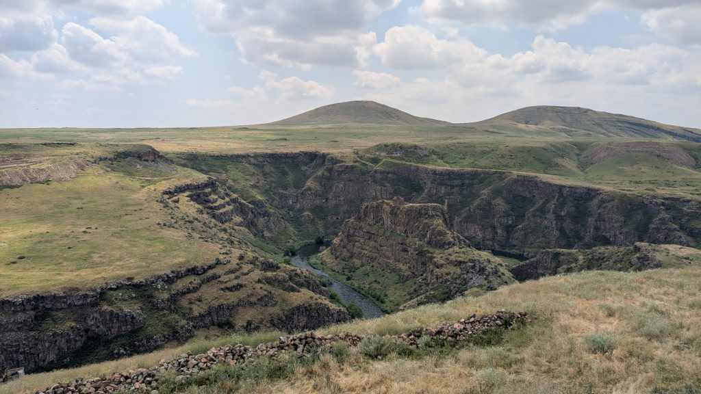
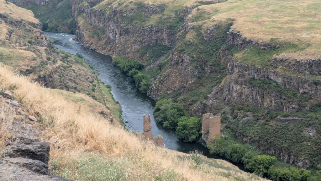
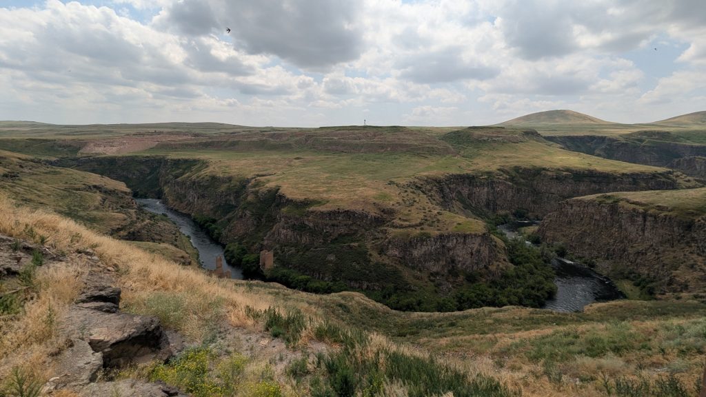
The Arpaçay River – known as the Akhurian River on the Armenian side – runs through the gorge below Ani, forming part of the modern border between Turkey and Armenia. From the ruins, you can clearly see the Armenian side, where some construction work was taking place during my visit. You can also spot caves carved into the cliffs.
For me and my weird obsession with borderlands, one of the most fascinating sights was the remains of the Silk Road Bridge, which once connected the two sides of the river. The bridge once formed part of the trade routes connecting Ani with the wider Caucasus and Anatolia. Turkey and Armenia reportedly agreed to restore the historic bridge as a gesture of goodwill between the two countries.
Despite visiting in early July, the landscape around Ani was surprisingly green. Wildflowers covered the plateau, and I even spotted a Caucasian mountain ground squirrel. It made the whole place feel much more alive than the rather bleak winter photographs of Ani I’ve seen online.
My walking route through Ani
Rather than heading straight for Ani Cathedral like most visitors seemed to do, I decided to make a sort of loop and explore some of the less obvious monuments first. I was also trying to avoid the crowds from my bus, which turned out to be an excellent decision indeed.
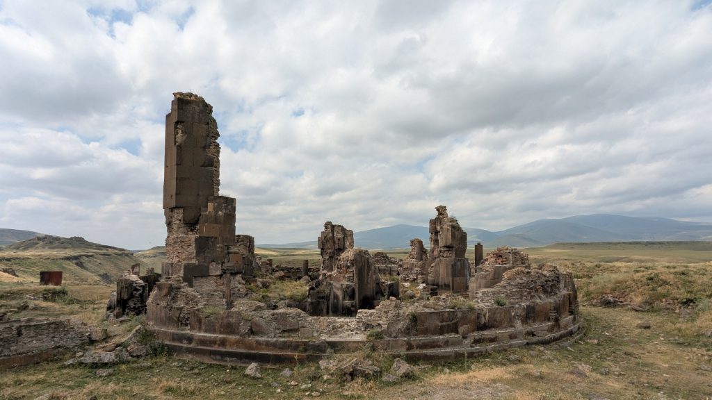
I used Yandex Maps (and guide books) to plan my route because I found that it had more of the individual monuments pinned than Google Maps. I first turned right towards the Seljuk Palace, before continuing to the enormous remains of St. Gregory of Gagik. Very little of the church survives today, but the huge circular base and fragments of its cylindrical pillars give you an idea of how impressive the building must once have been. I genuinely hope future conservation work can preserve and perhaps partially reconstruct what remains.
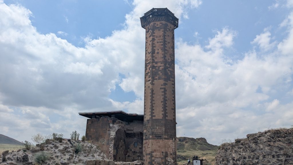
From there, I made my way towards Ebul Menuçehr Mosque, which has one of the best viewpoints over the gorge. and where you can see the remains of the Silk Road Bridge. Standing there and looking at the remains of a bridge that once connected the two countries is quite a strange feeling.
I then continued to Ani Castle and then to Ani Cathedral, which is every bit as impressive as I expected. By the time I reached it, most of the other visitors from my bus had already moved on, so my decision to come this way around the site first paid off.
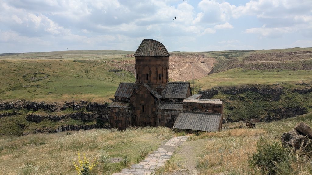
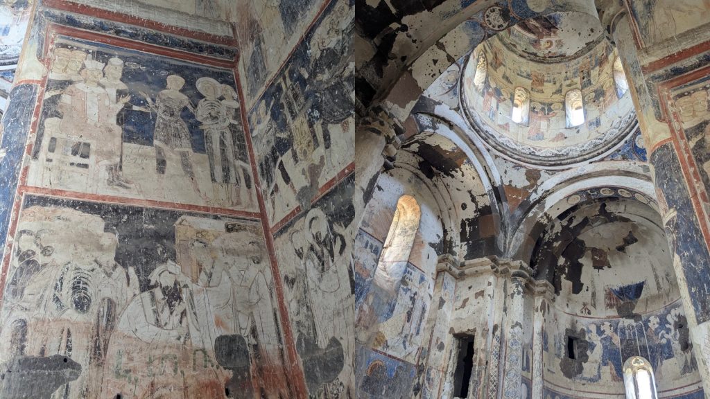
From the cathedral, I continued towards the Tigran Honents Church (St Gregory the Illuminator), which ended up being my favourite monument at Ani. The interior still contains remarkably well-preserved frescoes, with colours and figures that are much more visible than I expected. Unfortunately, idiots have also scratched their names into the walls. I really hope conservation work is carried out soon to protect these paintings before more damage is done.
From there, I gradually made my way back towards the entrance, stopping at several other ruins along the way.
If you have your own transport, I’d definitely allow more than two hours for Ani. There is far more to see than just the cathedral, and part of the experience is simply walking through the enormous landscape and trying to imagine what this city must have looked like when it was one of the major centres of the medieval Caucasus.
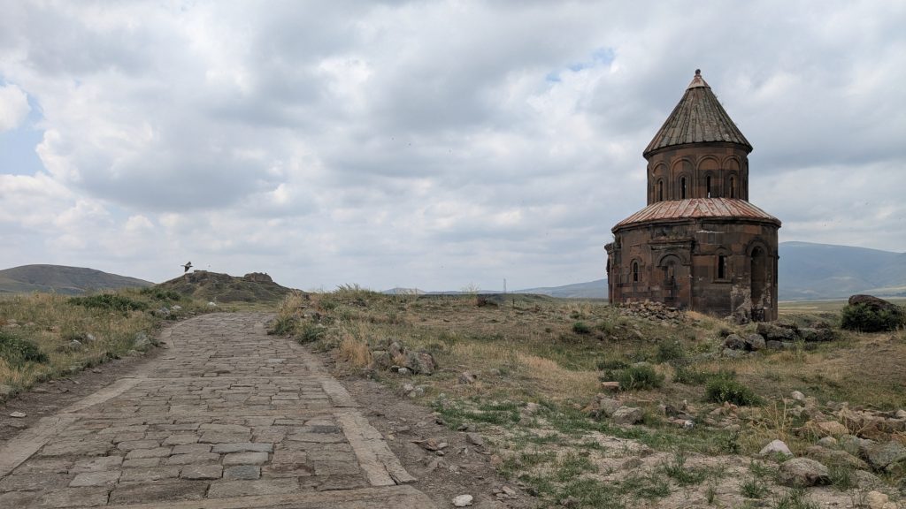
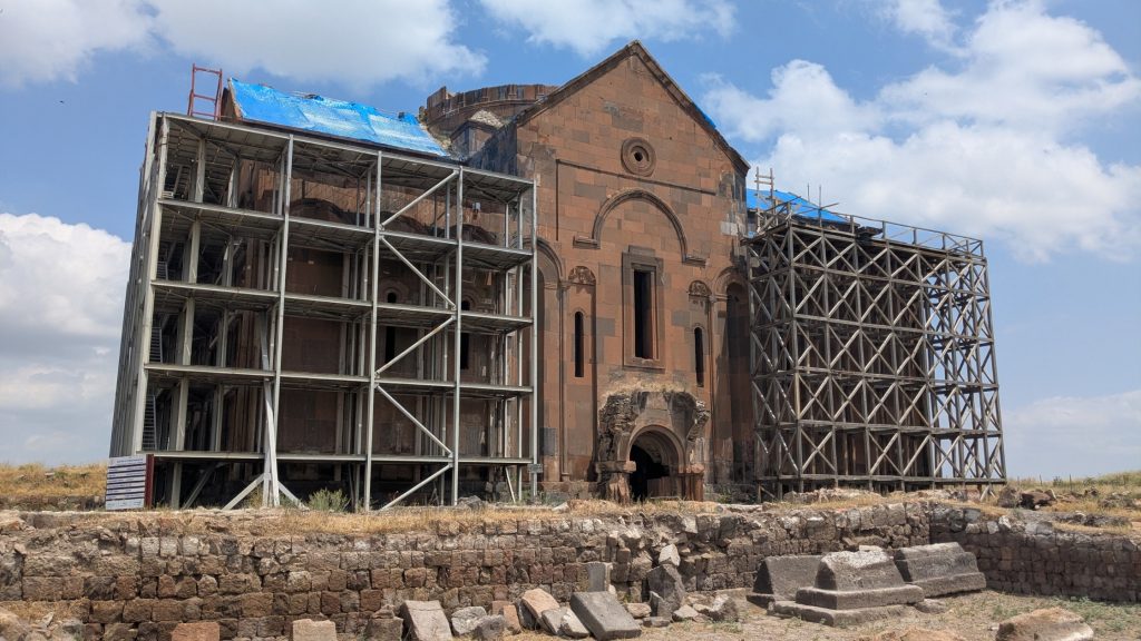
How to visit Ani from Kars
Visiting Ani independently from Kars is perfectly doable without a car. There are daily buses connecting Kars with the archaeological site during the high season (double check if you visit off season). I’d recommend getting to the Ani bus stop in Kars early, ideally around 8:30 am. The journey takes roughly one hour, and my bus was completely packed.
When I travelled there in July 2026, a return ticket cost 110 TL per person. The bus driver does not accept cash, it is card only!
The entrance to Ani was 430 TL, or around 8€ at the time of my visit. Unlike the bus, the entrance fee could be paid either by card or cash, but cash payments has to be made in Turkish lira obviously.
Don’t underestimate the time needed at Ani! This is the one thing I would change if I did the trip again.
The bus back to Kars left at 12:45 pm sharp and will not wait for late passengers (the driver was quite clear). Because the site is much larger than it looks on a map, I found myself watching the time towards the end of my visit.
I managed to see the main monuments, but I would have loved another hour or two to explore the more remote parts of the site without constantly thinking about the return bus.
So if you’re visiting Ani independently, keep an eye on the departure time and don’t leave the far end of the archaeological site until you’re sure you have enough time to walk back to the entrance. If you have your own vehicle, I’d definitely take advantage of the freedom and spend considerably longer at Ani.
Useful information, addresses & prices around Kars and Ani
• Where to stay: Hotel Kent Ani, a convenient central option, particularly if you’re travelling without a car.
• Where to eat: Hanımeli Kars Mutfağı, for regional Kars cuisine and Gafil Günah. Another local restaurant: Aşhana, where I tried hıngel/hangel.
• Kars to Ani: the bus stop is marked here on Google Maps, in front of the Gazi Ahmet Muhtar Pasha Mansion museum. I recommend arriving early in high season, as the bus can fill up quickly. It leaves Kars at 9 am and Ani at 12:45 pm sharp. 110TL return; Ani entrance fee 430 TL (~8€)
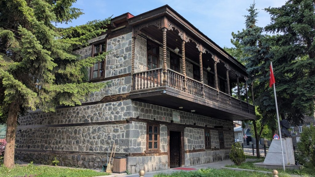 Gazi Ahmet Muhtar Pasha Mansion museum
My Eastern Turkey itinerary: 4 days from Nakhchivan to Georgia
A quick overview of the route I followed:
Day 1: Nakhchivan → Sadarak/Dilucu → Iğdır → Doğubeyazıt
Day 2: Doğubeyazıt → Iğdır → Kars
Day 3: Kars → Ani → Kars
Day 4: Kars → Ardahan → Posof → Türkgözü border → Vale → Georgia
I crossed into Turkey through the Sadarak-Dilucu border crossing, the land crossing connecting the Azerbaijani autonomous region of Nakhchivan with Turkey’s Iğdır province.
For the journey to Georgia, I continued via Ardahan and Posof to the Türkgözü-Vale border crossing. This route involves several connections, but it’s doable.
Practical information for travelling in Eastern Turkey
I won’t pretend to know Turkey inside out, I don’t. I’ve travelled through the country several times, but my experience is mainly of travelling overland and independently. These are the things I found useful during my time in eastern Turkey.
How to travel around Eastern Turkey without a car
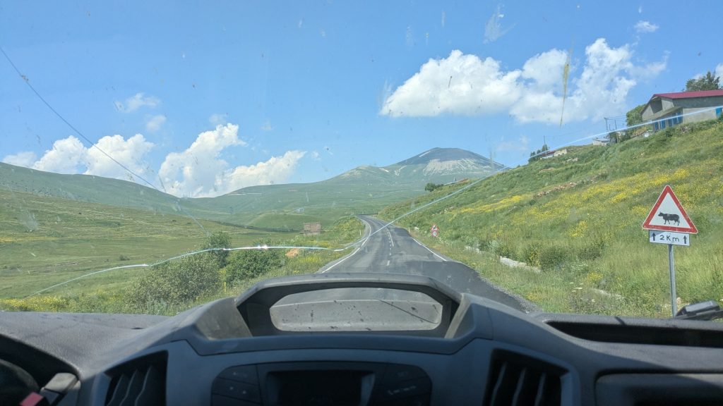
It’s absolutely doable. I travelled around the region entirely by public transport and found it much easier than I expected.
Dolmuş (pronounced dolmoosh) are the turkish equivalent to marshrutka. They are everywhere, and particularly great for shorter journeys between towns. I actually recommend them over the larger intercity buses: they leave from central locations rather than a bus station several kilometres outside town. Plus, you can just show up there, no need to buy a ticket days in advance.
How many days do you need?
Four days was enough for the route I followed, but I could easily have stayed a week.
If you have more time, I’d particularly recommend spending a few extra days around Mount Ararat and Doğubeyazıt, rather than simply rushing through the region to reach Kars and Ani.
When to visit Eastern Turkey
I travelled in early July, and the landscapes were still surprisingly green, with wildflowers covering the plateaus around Ani. It was hot in the lower areas around Doğubeyazıt and Iğdır, while Kars was much more pleasant.
Winter is a completely different story. Eastern Turkey sits at high altitude, and the windswept plateaus can become very cold (that wind..!) and snowy. If you’re coming primarily for hiking and landscapes, I’d choose late spring or early summer.
How much does a trip to Eastern Turkey cost?
I found eastern Turkey very affordable by Western European standards.
Accommodation was the biggest part of my budget, although breakfast was always included with the room. Local cafés, döner places and restaurants were inexpensive, and dolmuş and minibuses were particularly cheap. I spent about 170€ for 4 days, from the border of Nakhchivan to the border of Georgia.
Is Eastern Turkey safe for travellers?
I never felt unsafe travelling through eastern Turkey, including as a solo woman. The Jandarma checkpoints you encounter in the Kurdish-majority areas can look intimidating but I simply handed over my passport and was on my way.
Honestly, my bigger concern in eastern Turkey was the driving. On my way towards the Georgian border, there were several moments when I genuinely wondered whether I was going to make it there alive…
Resources I used to plan my Eastern Turkey trip
Online information about eastern Turkey is surprisingly limited, especially for practical logistics and historical context. I mainly relied on these resources:
• Bradt Guide: Eastern Turkey (2014) – by far the most useful guidebook I found, particularly for history and lesser-known places. Despite its age, I highly recommend it.
• Lonely Planet Turkey (2017) – useful for general planning and transport, but much less detailed on eastern Anatolia.
• Petit Futé Turquie (2025/2026) – a French travel guide, more up to date, but eastern Turkey receives relatively little coverage.
• UNESCO’s website – particularly useful for researching Ani and understanding its historical and architectural significance.
Tip: For current transport information, rely on the locals, they know.
Is Eastern Turkey worth visiting?
Absolutely! Even though I found some of the towns messy, I genuinely loved my short trip through eastern Turkey. The people I met were consistently kind and willing to help, and the landscapes are, quite simply, stunning.
What I particularly enjoyed was how different the region feels from the rest of Turkey. The Kurdish character of places like Doğubeyazıt is part of what makes travelling here so interesting, while the Russian and Caucasian influences around Kars add another layer to an already incredibly diverse region.
I only had a few days, but I left wanting to come back and explore more, especially around Mount Ararat.
Happy travels, and Jin, Jîyan, Azadî!